La sfida che abbiamo raccolto è la realizzazione della piattaforma di infomobilità dell’Alto Adige, che si declina nelle quattro seguenti attività principali:
- integrazione di dati e servizi di mobilità del territorio;
- implementazione del motore di calcolo del percorso;
- rilascio di API per l’utilizzo di terze parti;
- sviluppo del portale di front end altamente configurabile in termini di layout e funzionalità.
Il lavoro si inserisce in seno al progetto MENTOR, finanziato dal programma Interreg-V-A Italia-Svizzera, coordinato dal Comune di Merano e realizzato in collaborazione con NOI Techpark, SASA, il Comune di Brig-Glis nel Canton Vallese e Postauto. L’obiettivo del progetto, partito a fine 2018, è quello di dimostrare nei due Comuni pilota, rappresentativi dell’ambiente alpino, le potenzialità del “Mobility-as-a-Service” (MaaS).
NOI (l’agenzia in-house della Provincia Autonoma di Bolzano incaricata di stimolare attività di ricerca, promuovere innovazione scientifica e fungere da punto di riferimento per l’Information Technology sul territorio altoatesino) intende investire sul MaaS per diminuire l’utilizzo dell’auto privata a favore di modalità di trasporto più sostenibili, in linea con la propria missione di sviluppare nuovi prodotti e servizi, generando valore diffuso sul territorio e oltre confine.
Il contesto di partenza prevedeva:
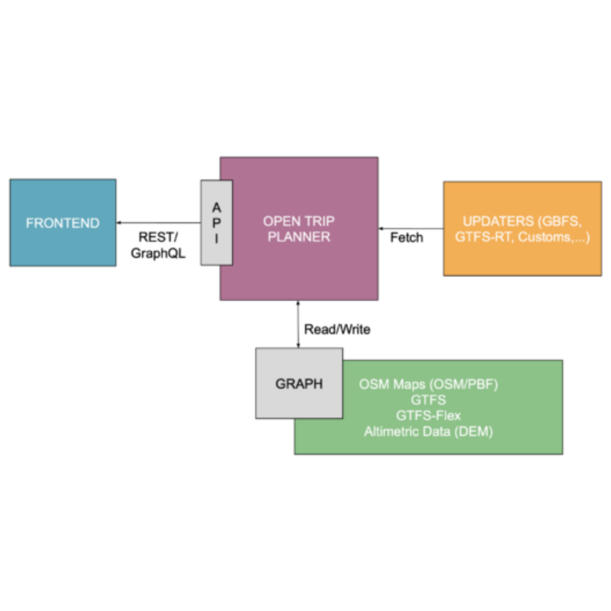
- la disponibilità di dati nel cosiddetto Open Data Hub, un aggregatore di dati open che si prefigge l’obiettivo di supportare l’implementazione di piattaforme innovative per la provincia di Bolzano;
- la volontà di puntare su tecnologie open source sostenute da una forte community di developer: OpenTripPlanner per il calcolo intermodale, Pelias per il geocoding e Docker per il deploy della soluzione;
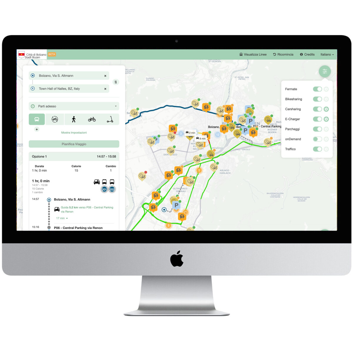
- il desiderio di sostituire il portale precedentemente utilizzato per trarre vantaggio dalle nuove funzionalità disponibili, migliorando l’esperienza utente, consentendo una più semplice integrazione di informazioni aggiuntive e ottimizzando lo scambio dati al fine di minimizzare l’elaborazione lato client e rendere l’applicativo performante anche in caso di hardware a limitate prestazioni.
Particolare attenzione è stata posta sulle specificità del territorio altoatesino, regione di confine tra Italia ed Austria con una forte presenza turistica e quindi con la naturale predisposizione al trilinguismo italiano, tedesco ed inglese.